

R51 Wide application integrated GNSS receiver
R51 Ubiquitous GNSS Receiver is based on GNSS high-precision positioning technology, MEMS sensor technology, 4G communication technology and single chip system technology research and development.


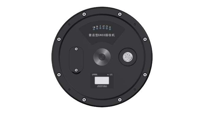
The whole system adopts a plug-in design, which greatly simplifies the installation process and improves work efficiency.
R51 is a low-power dedicated receiver for field geological disaster monitoring. Optional built-in lithium battery, solar panels are available.
The R51 universal GNSS receiver can be used with a third-party cloud platform to realize remote monitoring and management of equipment in the cloud.
Application field: can meet most needs of bridges, dams, mines, deformation monitoring
Signal tracking |
Accuracy Index |
Data interface: |
Physical properties |
|
BDS B1I/B2I/B3I |
Single point positioning: the unit is mm |
Data output: binary code, NMEA-0183Data refresh rate: default 1Hz, maximum 20HzBaud rate: 4800~406800Communication method: Full Netcom 4G, supportexternal communication moduleBluetooth: BT4.0, backward compatible with BT2.x,the protocol supports Windows/Android/IOS system | Working temperature: -45℃~+75℃ Storage temperature: -55℃~+85℃ Physical size: Φ196.7mm×129.5mm Protection class: IP67, floatable Humidity: 100% non-condensing Shock and Vibration: 2m drop resistance Indication: 6 LED indicators Weight: 1.65kg (including battery) |
Electrical parameters |
Operating mode |
Data output |
Inclination measurement parameters |
|
Power consumption: 1.5 ~ 4W, the power consumption depends on the communication method and GNSS board support power-on self-start,reverse polarity protection, built-in photoelectric isolation
|
Configuration mode: You can set the sampling frequency and upload interval independently of GNSS+MEMS data |
Differential data: RTCM2.X, RTCM3.X,CMR, CMR+ Data format: NMEA-0183, binary code |
Measuring range: ±90° Measurement accuracy: 0.1° Acceleration Measurement Parameters Measuring range: ±2g Measurement accuracy: 0.01g |
Interface mode |
Protocol |
|
|
| 1 9-pin aerial plug connector (1 solar,1 battery, 1 mains, 1 serial) 1 SIM card slot |
Network: TCP, MQTT, Ntrip Serial port: RS232 protocol, RS485protocol |
 R51
R51


About Us
Shanghai AllyNav Technology Co., Ltd. was established in 2015. Based on GNSS navigation, AllyNav expands the application of the agricultural science industry, focusing on agricultural IoT, agricultural machinery autopilot, and the core algorithms of autonomous. We have exported to more than 30 countries like Canada, Brasil, Argentina, Spain, Russia, South Africa, Japan, Thailand, etc. AllyNav products provide farmers with precise and efficient solutions, to free farmers' hands and highly increase production capacity.


Contact Us
ADD: 1.Room 201, Building No.1, Lane 215, Gaoguang Road, Qingpu District, Shanghai , China
TEL:+86 21-61200180
E-MAIL:globalsales@allynav.cn
Subscribe

Copyright © 2023 Allynav All Rights Reserved |