

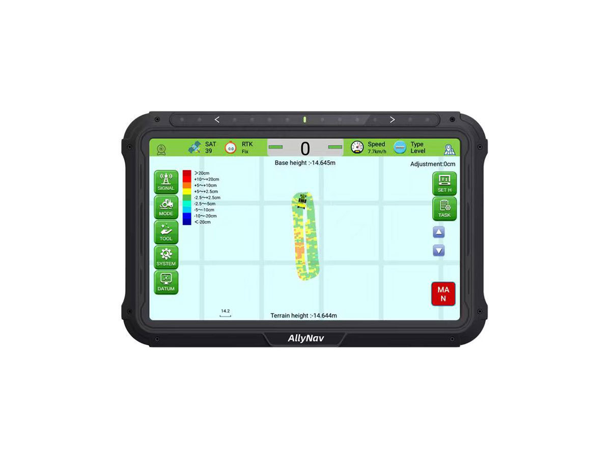
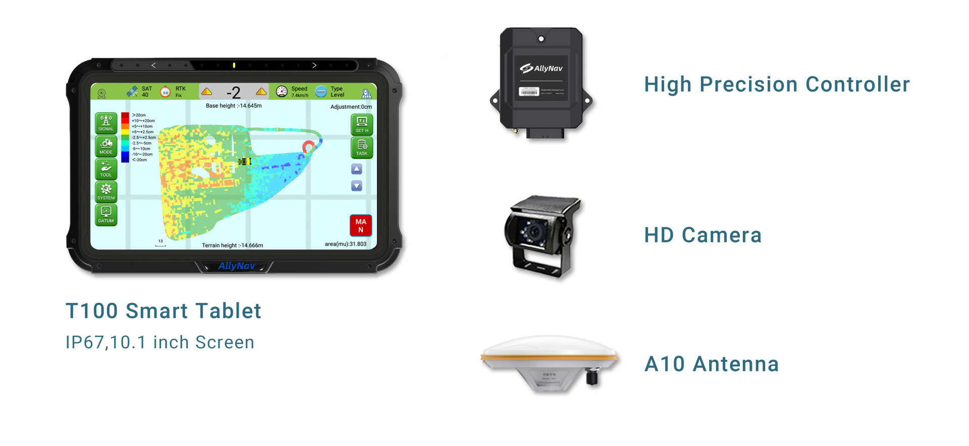
T100 Smart Tablet
Embedded with high precision GNSS module, providing ±2.5cm precision level slop leveling.
Display: 10.1 inch, multi-point capacitive screen
Resolution: 1024*600
Brightness: 750nits
CPU: ARM Cortex-A7, 1.5GHz
RAM/ROM: 2G/16G
Communication interface: USB, CANBus, Serial, LTE
Wireless communication: dual 4G, WIFI, Bluetooth
System: Android 6.0
Protection level: IP67
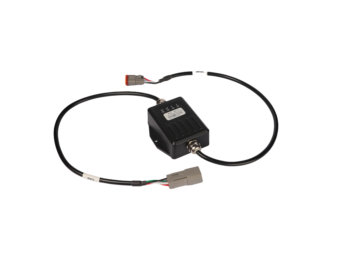
High Precision Controller
Receive tablet control signal and output control solenoid valve signal.
Communication interface: CAN
Input control: 2-way analog (voltage)
Output control: 2 channels (switch signal/PWM)
Working voltage: 9~30V DC
Protection level: IP67
Physical size: 120×81×34mm (without cable)
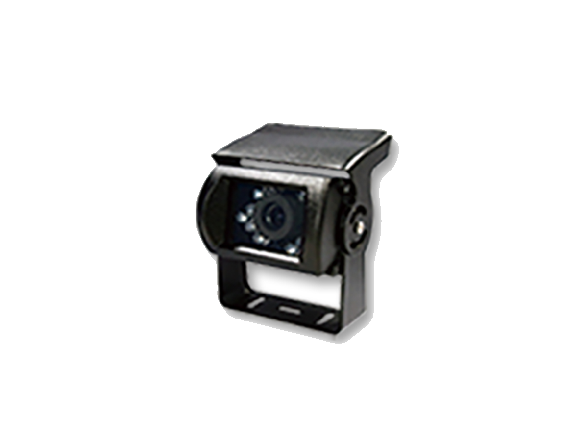
HD Camera
Visible working footprint and topographic map. Increase 30% leveling efficiency.
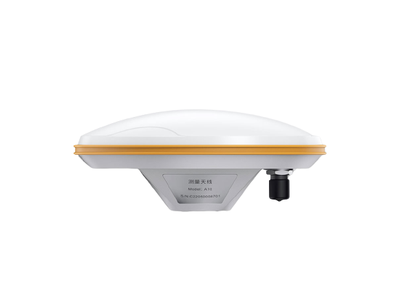
A10 High-Precision Positioning Antenna
Receive the satellite signal and send the satellite signal to the positioning boardFrequency Range: GPS L1/L2、BDS B1/B2/B3、GLONASS L1/L2
Impedance: 50 ohms
Polarization method: right-hand circular polarization
Antenna axial ratio: ≤3dB
Horizontal coverage angle: 360°
Gain: 40 ±2dB
Working voltage: 3.3~12VDC
Working current: ≤45mA
Joint form: TNC female
Physical size: φ152*63mm
Weight: ≤450g
Humidity: 95% non-condensing
Match multiple scrapers.
Mobile Base Station, Simple to set up.
Scalable Auto-steering, Guidance System, Smart Spray System.
Visible working footprint and topographic map. Increasing 30% leveling efficiency.
Strong adaptability and all weather operations.
 W20Pro
About Us
Shanghai AllyNav Technology Co., Ltd. was established in 2015. Based on GNSS navigation, AllyNav expands the application of the agricultural science industry, focusing on agricultural IoT, agricultural machinery autopilot, and the core algorithms of autonomous. We have exported to more than 30 countries like Canada, Brasil, Argentina, Spain, Russia, South Africa, Japan, Thailand, etc. AllyNav products provide farmers with precise and efficient solutions, to free farmers' hands and highly increase production capacity.


Contact Us
ADD: 1.Room 201, Building No.1, Lane 215, Gaoguang Road, Qingpu District, Shanghai , China
TEL:+86 21-61200180
E-MAIL:globalsales@allynav.cn
Subscribe

Copyright © 2023 Allynav All Rights Reserved |